I was thinking about the 17-Mile Drive, that beautiful stretch along the coast from Pacific Grove to Pebble Beach, as I paddled out. My destination was a mysterious fishing spot 7 miles offshore which I discovered during a previous expedition. I knew that I had a long day ahead of me.
Posted on March 28, 2020
I woke up in the middle of the night, got a boost from a double shot of espresso, and arrived at Moss Landing just in time for sunrise. There was no time to waste.
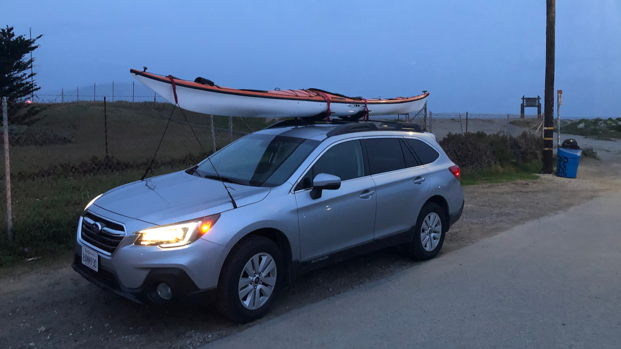
Rigging the kayak was quick and without further delay I pushed off. It was quiet. There were no other people around, neither at the baeches nor on the water. Salmon season was still a week away and the Corona crisis may have done its part to silence the landscape. Even the birds were quiet, the seals weren't barking and the pelican birds were mostly absent; alltogether not a good omen for a fishing trip.
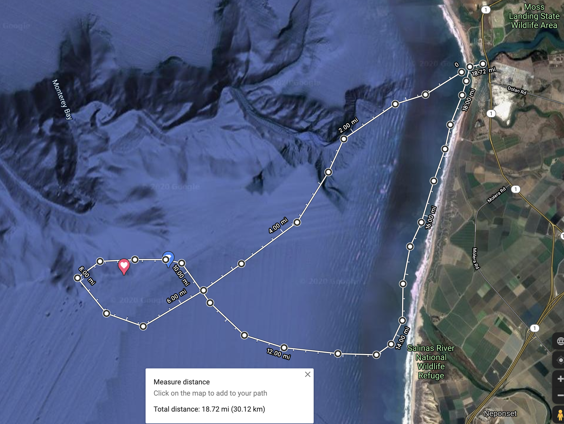
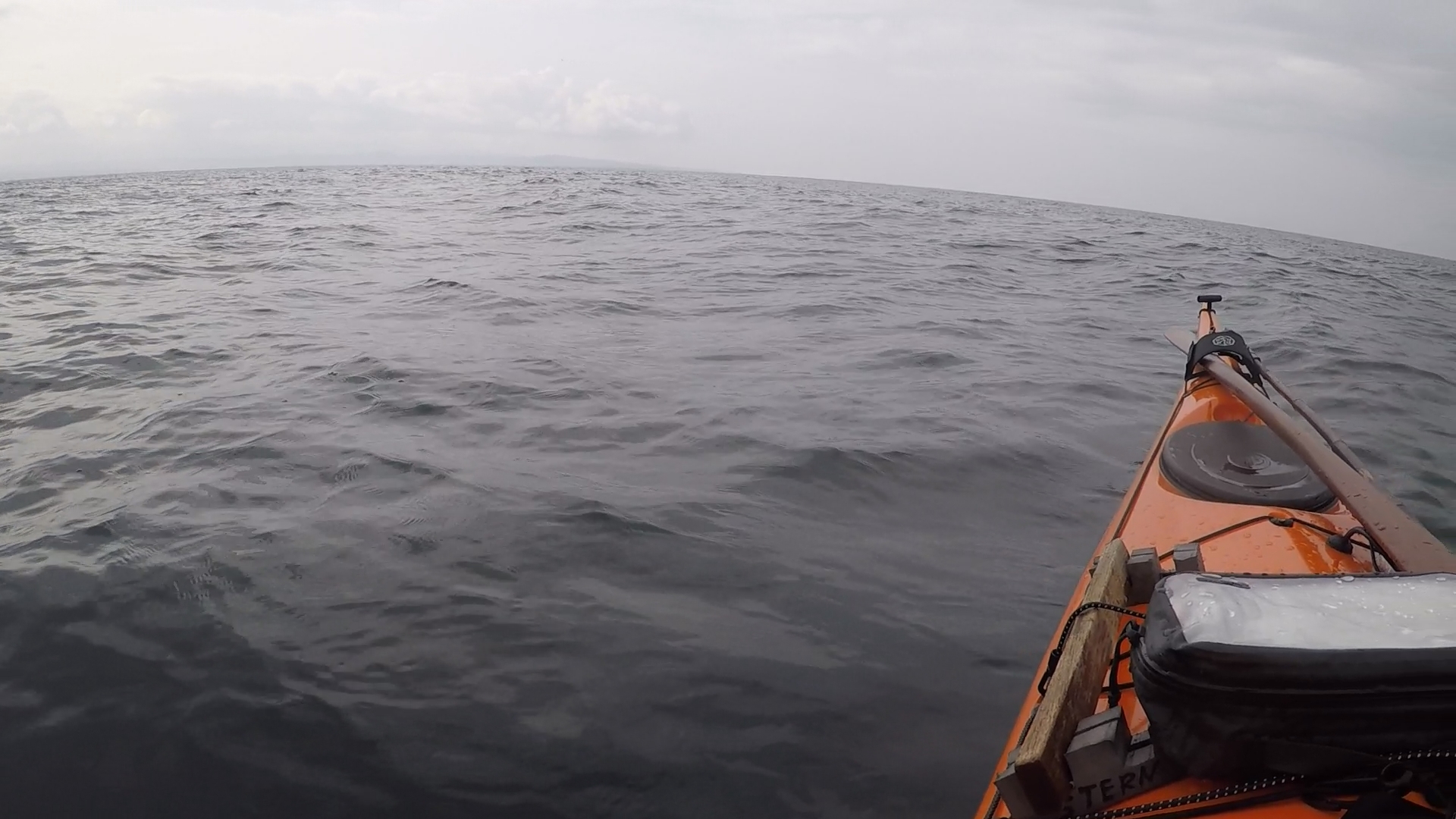
I paddled WSW for the first two hours. The wind laid down, swells were less than three feet, there was little activity above or below my kayak. I had hoped to find schools of anchovies or sardines. Mackerels, my favorite amongst the smaller pelagics, weren't schooling around either, and whales, dolphins and other sea creatures stayed out of sight with the exception of the occasional jelly fish. I also noticed quite a few islands of dislocated kelp floating by. This could be a problem next week for those trolling for salmon.
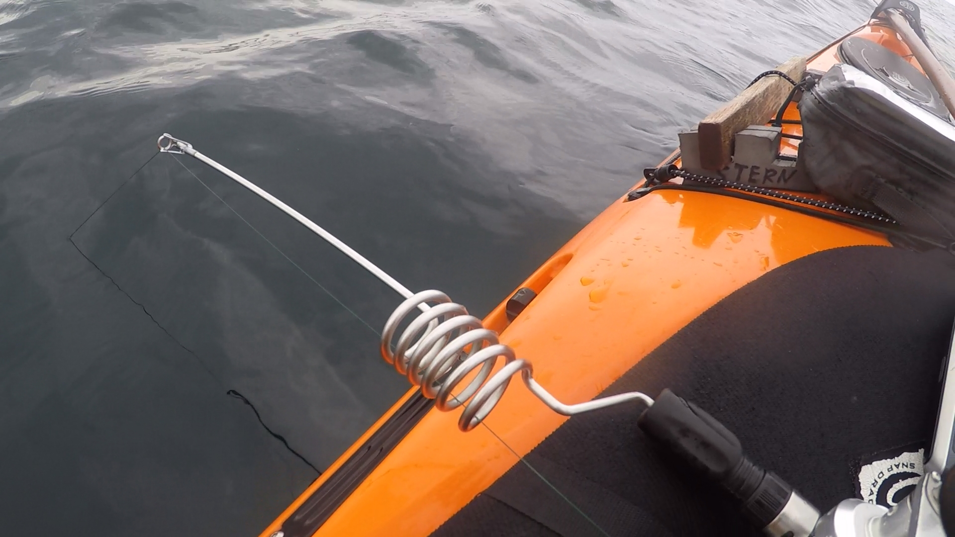
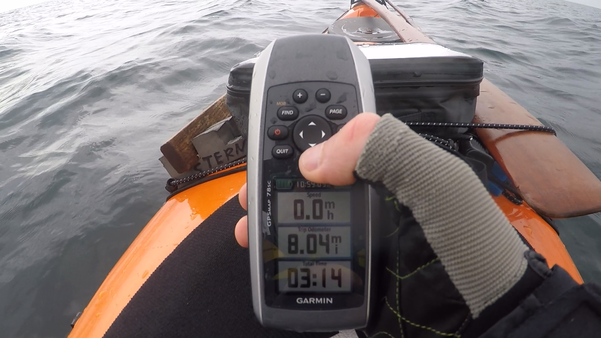
At the spot I baited a 4-hook rig with chunks of octopus and lowered it to the sea floor. The depths in this area range from 250 to 350 feet as the seabed slopes down towards the Monterey Canyon. While I use or short rod and a conventional reel I fish these depths handline-style by holding the braided line between my finger tips.
Soon I felt a little tug and reeled up two sand dabs. Another dab on the next drop. On the third drop I felt a heavy pull with all the tell tales of Petrale Sole. Oh, this was a big one. I slowly worked it up from 300 feet and it fought all the way. Only for the last few feet the pull stopped. This was unusual but soon I saw what happened: I had hooked a school of red colored rockfish, three canaries and another one which looked a bit different but possibly a canary as well. This was not supposed to be happening. There weren’t any structures within miles, just sand and mud. And rock fishing was closed for another 4 days. I revived two of the fish and they went back down. The other two didn’t make it and when I saw them floating away on the ocean surface I felt quite discouraged and stowed away my fishing gear.
Rather than unnecessarily hooking more rockfish I decided to go for a long return paddle past the beaches of Mulligan's Hill and back up the coast to Moss Landing.
A couple of hours later I arrived at Mulligan's Hill. What had looked like a lovely beach with gentle surf break from the distance turned out to be heavy breakers. The beaches in this area are steep and produce an equally steep shore break which would be difficult to surf as it builds up so quickly and collapses with force. My plan to make landfall and take a break didn't look so good. It could have easily earned me a trip to a hospital, a bad idea especially these days, or loss of gear, or both. The boat started to feel really heavy but I kept my head down and continued to make my way up the coast and back to the harbor.
The beaches south of Moss are vast and should have lots of potential for halibut, starry flounder and other fishes. I need to spend more time exploring these areas.
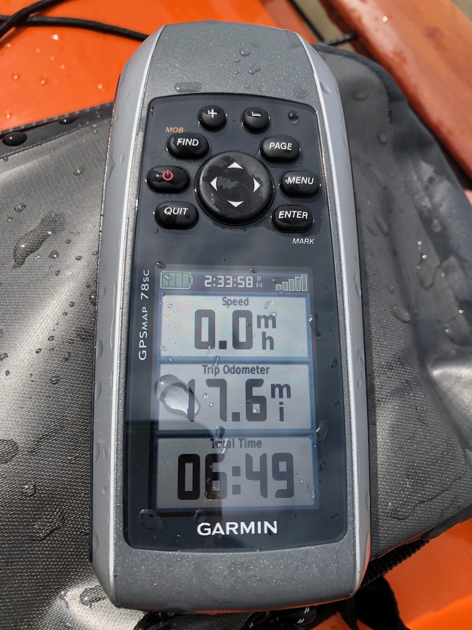
The paddle was a bit far. At this early point in the season I am in shape for 10 miles, still ok after 12, but the final 5 to 6 miles hurt more than I like to admit.